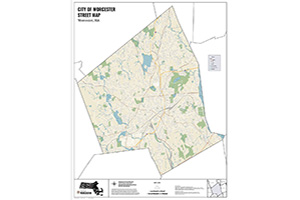
Explore the many Online Maps for the City of Worcester. These maps cover a variety of topics and departments city-wide.
The City of Worcester Geographic Information System (GIS) Section strives to provide high quality GIS services to City of Worcester staff and the public. Browse our two Open Data Portals for detailed City data, maps and more.
City Maps
Bike Parking

An interactive map showing the location and types of publicly accessible bike parking in Worcester.
District/Ward/Precinct Maps

View maps of the Redistricting Council District, School Committee Districts, State Representatives & State Legislature Districts and Ward/Precincts.
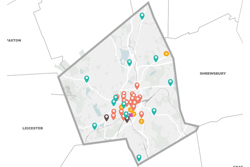
Housing Development Projects

This map displays the location of Housing Development Division projects which were active in 2025. The location of each project is color-coded to indicate which program was utilized by the homeowner or developer in partnership with the City of Worcester.
Hydrants & Catch Basins
An interactive map helps citizens to locate Fire Hydrants & Catch Basins to keep them clear of snow and debris.
Lakes & Ponds

View the map of Worcester's Lakes & Ponds and learn about what you can do at our public waterbodies.
Naloxone & Sharps Disposal Locations
View a map indicating locations where Naloxone is available, along with Sharps Disposal Locations.
Police Maps

View the City of Worcester Police Precincts Map and the Police Sectors and Street Routes Map.
Speed Humps

Map and summary detailing the installation status for both permanent speed hump locations and temporary (seasonal pilot speed hump locations) within Worcester.
Trash & Recycling Collection

View the Trash & Recycling Weekly Collection Schedule. Set recyclables and trash at the curb between 6 a.m. and 7:30 a.m. on your scheduled trash/recycling day.
Youth Out of School Time Resource Map

This interactive map provides a general overview of the City of Worcester's youth program options, including after school and vacation programs.
Zoning Ordinance & Map
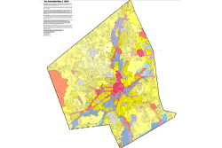
Each zone classification guides the physical development of the city through a set of requirements set forth in the City of Worcester's Zoning Ordinance as amended.
Disclaimer: The information represented on these maps was provided to the Department of Innovation & Technology by the City Departments/Divisions responsible for producing and maintaining such data (Assessing, Election Commission, etc). This information is assumed to be accurate but may not reflect the most current information or may contain errors. Official records may be obtained by the Department/Division responsible for the information. No representations are made as to property boundary lines or other matters relating to the legal title or ownership rights of the properties shown herein. The City of Worcester makes no warranty, representation or guaranty of any kind as to the content within these pages and assumes no liability for the use of the information depicted herein.
Worcester Atlas
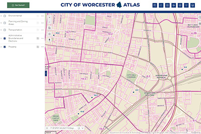
Worcester Atlas is an interactive map viewer that provides residents with access to City property data and records plus many other City map layers.
Winter Parking Viewer


Property Records
Search Worcester property records for property card data including values, ownership, land use, etc. You can also explore the Worcester Atlas map viewer, Winter Parking Ban Viewer and Permit History.
Contact Information
Address
Innovation and Technology
Worcester Technical High School
1 Officer Manny Familia Way, Building A
Worcester, MA 01605
Contact
Phone: 508-799-1272
Fax: 508-799-1270
ContactDoIT@worcesterma.gov
Hours
Monday - Friday
8 a.m. - 5 p.m.