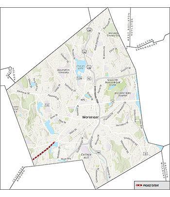
 Stafford Street is an approximately 2-mile minor arterial street linking the Webster Square with adjacent commercial and retail businesses, residential neighborhoods and the Town of Leicester. While the street technically has two travel lanes, the lack of pavement markings and inconsistent parking usage leaves very wide travel lanes. The roadway's present configuration contributes to excessive speeding, with 15% of traffic traveling at speeds of 35mph or greater in the more developed sections east of James Street and 15% of traffic traveling at highway speeds of 39 mph or greater west of James Street.
Stafford Street has experienced 246 crashes over the last five years along the corridor including 36 in Webster Square, 41 at Heard/Curtis Parkway and 30 at James Street. This corresponds to a crash rate that is 60% higher than the statewide average for urban minor arterial roadways along the central corridor. Sixty-nine crashes included non-fatal injuries, although one crash included a 5 year old pedestrian in the crosswalk who died at the hospital as a result of injuries caused in the crash. Four crashes involved bicyclists and pedestrians, who are especially vulnerable to serious injury.
Pedestrian accommodations vary throughout the corridor with respect to surface condition and require reconstruction, including curb ramps, to make them ADA compliant. The corridor lacks sidewalks west of Abington Street. There are no bike/micro-mobility accommodations and many WRTA bus stops are not ADA compliant.
Due to advanced deterioration of the roadway surface, The Department of Public Works & Parks (DPW&P) completed a pavement and sidewalk restoration project between Webster Square and the intersection with Curtis Parkway in 2022. In 2024, the DPW&P is completing the pavement and sidewalk restoration to the Leicester cityline. As part of the project, the City will implement a Complete Streets improvement plan using pavement markings, curb alignments, curb extensions and rectangular rapid flashing beacons to improve safety and access for all users including pedestrians, cyclists, micro-mobility users, public transit riders and motorists.
An informational meeting concerning the ongoing pavement preservation project, interim improvements and long-term plans was held on April 22, 2024 at Our Lady of the Angels Catholic Church.
Revisions to lane markings and curb alignments are being implemented as part of the pavement reconstruction project. These changes will formalize parking along the corridor as well as improve safety and expand accommodations for all roadway users including pedestrians, cyclists, micro-mobility users, public transit riders and motorists. These changes are in line with federal & state design guidelines and industry best practices.
A public meeting is scheduled for March 7 to discuss proposed complete streets improvements that can be quickly and cost effectively implemented through lane marking and curb adjustments as part of the roadway reconstruction project. In accordance with the City's approved Complete Streets Policy and Green Worcester Plan, the following changes are being implemented at present:
Rightsizing the roadway (road diet) to formalize the travel lanes to one in each direction and establish standard 11-foot travel lane widths, which will help reduce motor vehicle speeding.
Formalize existing on-street parking to improve access to area businesses and residents.
Add a buffered bike lane in each direction. Where on-street parking is provided, the buffer will be located between the bike lane and the parked motor vehicle creating a door zone buffer. This approach improves safety for cyclists and by providing a buffer from the opening of driver's side doors from parking motor vehicles and will help to prevent the 'dooring' of cyclists along the corridor.
ADA ramps at crosswalks within the project limits will be evaluated and upgraded as necessary to comply with ADA requirements. Signage and "daylighting" to improve pedestrian visibility will be implemented at select crosswalk locations through the use of curb extensions.
New sidewalks will be installed in locations that currently lack sidewalks between west of Abington Street and New Balance Fields.
Solar powered Rectangular Rapid Flashing Beacons (RRFB) are proposed for high demand crosswalks throughout the corridor.
Transportation & Mobility
76 East Worcester Street
Worcester, MA 01604
Phone: 508-929-1300 ext. 49500
Fax: 508-453-2888
Email Us
Office Hours:
Monday - Friday
8:30 a.m. - 5 p.m.


