Enabling more trips by bike and micro-mobility devices is essential to reaching Worcester's climate and public health goals. We need to make sure our streets are safe for those who bike today - and for the many more who will choose to ride tomorrow. The City, through projects initiated by the Department of Transportation & Mobility and the Department of Public Work & Parks, are working to build new high comfort bike facilities and upgrade existing bike facilities to be more comfortable.
While each block of safe, comfortable bike lane is important, it's more important that they connect to each other. A connected network is worth more than the sum of its parts. However, a network is not constructed overnight and each project implemented is working toward the construction of a safe and accessible Bike and Micro-mobility Network that will connect all neighborhoods to commercial, educational, recreational and health care related facilities throughout the City.
Bike and Micro-mobility infrastructure is not one size fits all. The type of facility constructed on our public streets need to be context sensitive and take into account many different factors and demands on the limited right of way space with the ultimate goal of providing the highest degree of separation and comfort possible. Below is information on different bike and micro-mobility facilities that you can expect to see installed throughout the City of Worcester in the coming years.
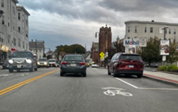
Conventional bike lanes are dedicated on-street facilities for cyclists and micro-mobility users. These lanes are adjacent to the vehicle travel lanes and are marked with solid white stripes. Cyclists travel in the same direction as motor vehicle traffic. Conventional bike lanes are typically placed to the right of motor vehicle traffic, between the vehicle travel lane and the curb (or parking), but occasionally may be placed on the left side of the road on a one-way street.
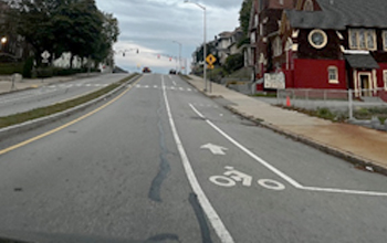
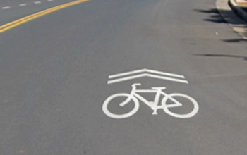
Cyclists and micro-mobility users are permitted to use any roadway except limited access highways. Shared lane markings, commonly called sharrows, are reminders to motorists that bicyclists are allowed to use the full travel lane just like motor vehicle traffic. The markings for a sharrow include a bicycle and two chevrons above the bicycle. Under Massachusetts law, drivers must wait until it is clear to pass a cyclist and provide a safe passing distance of at least 4 feet.
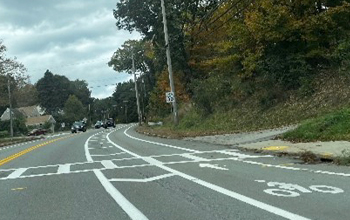
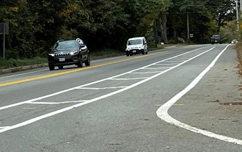
Buffered bike lanes are bike lanes with a painted buffer between the bike lane and the vehicle travel lane. Buffers are typically marked with two white lines and diagonal or chevron markings between the two lines.
Parking protected bike lanes are similar to buffered bike lanes, except they are separated from motor vehicle travel lanes with a parking lane. In these cases, the buffer is created between the parking space and the bike lane. It sometimes includes bollards or planters to add extra separation between the parking lane and the bike lane.
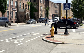
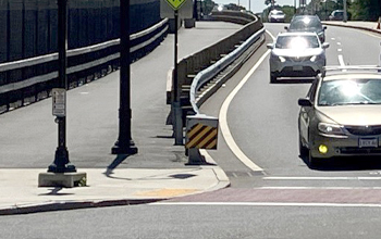
These bike lanes are typically separated, or protected, from motor vehicle travel lanes with physical elements such as bollards, planters, concrete curbs, etc. and from pedestrians on the sidewalk. These facilities can be designed for one-way or two-way travel, depending on the right of way width.
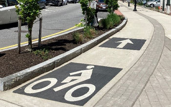
Shared Use Paths are sidewalk-level biking facilities that are shared with pedestrians. These facilities are adjacent to vehicle travel lanes, without placing cyclists and micro-mobility users directly on the street. Shared Use Paths may also be bidirectional, allowing cyclists to travel in both directions. Cyclists using shared used paths must remain alert to pedestrians and other cyclists.
Transportation & Mobility
76 East Worcester Street
Worcester, MA 01604
Phone: 508-929-1300 ext. 49500
Fax: 508-453-2888
Email Us
Office Hours:
Monday - Friday
8:30 a.m. - 5 p.m.


