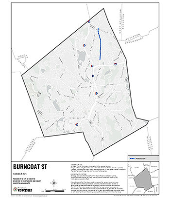
 Burncoat Street is an approximately 3.5 mile collector road that expands across various neighborhoods, including Britain Square, Greendale and Burncoat. This project will focus on approximately 1.9 miles of the corridor from Mountain Street East to Randolph Road/North Parkway. There are various schools and destinations along this corridor, including Burncoat Middle snf High Schools, Burncoat Street Prep, Quinsigamond Community College and the Burncoat Branch Library. The WRTA Route 14 provides bus connections between the downtown Hub and Price Chopper. The roadway's current configuration results in wide lanes that favor speeding along the corridor. Although the speed limit is 30mph, the 85th percentile speed is between 37-38 mph, which means 15% of traffic is traveling above 38 mph and places vulnerable road users at a greater risk of injury.
Burncoat Street experienced 157 crashes between 2016 - 2022, with 38 of those crashes, or 21%, categorized as injury crashes. There were also 8 crashes involving a cyclist or pedestrian during this time period. The 1.9 miles of the project extent doesn't have any signalized intersections, which makes it challenging for pedestrians and cyclists to cross the street.
Pedestrian accommodations vary throughout the corridor with respect to surface condition and require reconstruction, including curb ramps, to make them ADA compliant. The corridor lacks sidewalks by Quinsigamond Community College and there are large sections without safe pedestrian crossing opportunities. There are no bike and micro-mobility accommodations and many WRTA bus stops are not ADA compliant.
A section of Burncoat Street from Clark Street to Burncoat Terrace is also part of the proposed Complete Streets Prioritization Plan.
An informational meeting concerning the ongoing pavement preservation project, interim improvements and long-term plans was held on Thursday, May 9, 2024 at St Michael's On-The-Heights.
The DPW&P will be resurfacing the roadway as part of their annual pavement management program, and in line with the City's Complete Streets Policy, revisions to lane markings and curb alignments will be implemented as part of the project. These improvements will improve safety and access for all roadway users including pedestrians, cyclists, micro-mobility users, public transit riders and motorists. These changes are in line with federal and state design guidelines, City policies and industry best practices.
Rightsizing the roadway to formalize the travel lanes and establish standard 11-foot travel lane widths, which will help reduce motor vehicle speeding.
Add designated on-street arrival and dismissal zones at Burncoat Middle School and High School.
Add a street-level bike lane in each direction, with buffered bike lanes where spaces allows between Blue Bell Road and Hartford Road.
Construct new ADA compliant curb ramps at crosswalks within the project limits. Install signage at all crosswalks across Burncoat Street to improve pedestrian visibility. Add additional crosswalks to improve walkability and pedestrian connections along the corridor.
New sidewalks will be installed in locations that currently lack sidewalks between Marland Road and Arbutus Road and non-ADA compliant sidewalks will be reconstructed.
Solar powered Rectangular Rapid Flashing Beacons (RRFB) will be installed at high demand crosswalks.
This project will cost approximately $2,100,000 and is scheduled for construction in 2024/2025.
Transportation & Mobility
76 East Worcester Street
Worcester, MA 01604
Phone: 508-929-1300 ext. 49500
Fax: 508-453-2888
Email Us
Office Hours:
Monday - Friday
8:30 a.m. - 5 p.m.


